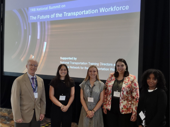
Authors: Alexa Fitzpatrick, Charlotte Pulido, Devin Wilson, Hildana Liben, and Tracy Gage
We are pleased to share the impressions and action points that were gleaned from the TRB National Workforce Summit by a group of Interns attending with the Colorado Department of Transportation. We appreciate their participation during and their willingness to share what they felt was most important coming out of the Summit.
Day 1
Setting the Stage: Urgency, Equity, and Strategic Leadership
The Future of the Transportation Workforce conference brought together public and private sector leaders, researchers, and practitioners from across the nation to tackle one of the transportation sector’s most pressing challenges: building and sustaining a skilled, diverse, and resilient workforce. Throughout the three-day event the following questions were explored:
1. How do we attract and engage a diverse workforce?
2. What kind of workforce do we need for the 21st century?
3. What business models and tools sustainably support workforce needs?
The conference served as an important platform for sharing strategies and fostering a proactive approach to workforce development in transportation.
Opening Keynote: Philip Washington
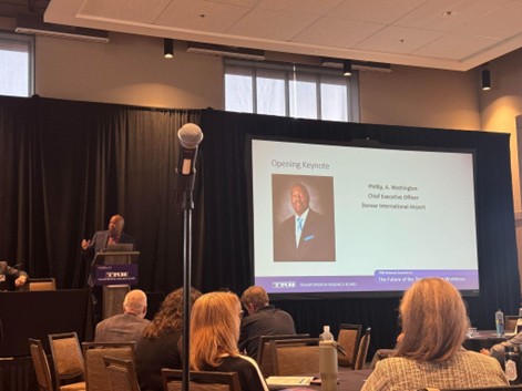
Philip Washington, CEO of Denver International Airport (DIA) and former CEO of the Los Angeles Metro, opened the conference with a powerful keynote addressing the existential threat posed by a lack of qualified workers in transportation. Drawing on his personal experience growing up in a transit desert and serving in the military, Washington underscored the need to evaluate a person’s potential, not just their credentials, when hiring. While technical proficiency is important, he argued that soft skills such as communication, adaptability, teamwork, and emotional intelligence are equally vital to building a robust workforce. These skills not only enhance collaboration and workplace culture, but also prepare employees to grow into leadership roles and navigate an industry undergoing rapid transformation.
Washington also highlighted the need to create inclusive, equitable pathways into the industry, starting as early as possible. He described initiatives such as The SEED School of Los Angeles County and Denver International Airport’s Ex-Offender Program, both of which expand access to career opportunities while fostering long-term economic mobility. His inspiring vision for a more inclusive workforce highlights the transformative power that nurturing talent can have on individuals and communities. Washington’s deep commitment to shaping the future of transportation reflects a broader dedication to equity, opportunity, and the continued evolution of the industry.
“Workforce development is a righteous and patriotic act.”
– Phil Washington
Dr. Tyler Reeb: Fourth Industrial Revolution (4IR)
Dr. Reeb explored workforce development in the context of the Fourth Industrial Revolution (4IR), marked by technologies like artificial intelligence and robotics. He talked about the challenges and opportunities presented by this new era, speaking of the importance of equipping the workforce with the necessary skills and knowledge to thrive amidst rapid technological change. Through this conversation, Dr. Reeb provided valuable insights into how transportation professionals can navigate the complexities of a rapidly changing industry while fostering innovation and adaptability in the transportation workforce of tomorrow. His insights emphasized adaptability and innovation as keys to future success.
Panel: Strategic Workforce Planning at State DOTs
Leaders from Minnesota (MnDOT), Vermont (VTrans), and Wisconsin (WisDOT) discussed how their agencies are navigating today’s workforce challenges with innovative, data-driven approaches. Taken together, the insights from Gross, Hetzel, and Sarver offered a powerful blueprint for rethinking how transportation agencies can cultivate a resilient, engaged, and future-ready workforce.
- Cindy Gross (MnDOT) discussed the agency’s 2025 plan to address issues such as an insufficient number of applicants to fill open positions and the loss of institutional knowledge as employees retire. This plan includes several systematic steps, such as organizational reviews and a gap analysis. Early outcomes from these initiatives are very encouraging, and MnDOT has reported an increase in job applicants, fewer re-postings, and improved selection rates for qualified candidates. Gross also notably introduced the concept of “toxic nostalgia,” which warns against the pitfalls of clinging to outdated practices that hinder progress in a rapidly evolving environment.
- Christine Hetzel (VTrans) emphasized the need for regular coaching and feedback, cohesive teams, and clear advancement paths, all of which are critical for improving employee retention, performance, and overall workplace morale. Hetzel introduced the VTrans Strategic Workforce Plan for 2024-2025, which features a visual roadmap with strategic alignment, organizational reviews, and a gap analysis that will help the agency identify and address staffing needs.
- Randy Sarver (WisDOT) discussed how his agency responded to post-COVID workforce dissatisfaction by creating a dedicated Office of Workforce Development. By listening to employees and analyzing internal data, WisDOT built a team specifically tasked with long-term retention and empowerment strategies. Sarver emphasized the importance of demonstrating to employees that they are a true priority by dedicating resources and truly investing in the effort.
Closing Keynote: Carlos Braceras
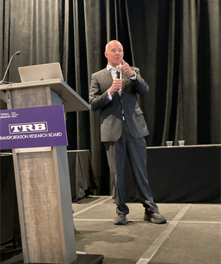
The final speaker of the day, Carlos Braceras, Executive Director of the Utah Department of Transportation (UDOT), delivered an energizing and heartfelt address on what it takes to build and sustain a workforce prepared for the future. He emphasized that while competitive pay may attract people, it is workplace culture, rooted in trust, engagement, and well-being, that ultimately inspires them to stay. “The currency of any agency is trust,” he noted, underscoring that that trust must be continuously earned through listening, responsiveness, and support. Braceras encourages leaders to serve as both formal and informal trainers, promoting continuous learning as a condition of life and as essential to both personal and organizational growth. He advocated for a workplace where people are heard, valued, and even enjoy themselves, noting, “they need to have fun.” Through these reflections, Braceras reinforced a clear vision: the future of transportation depends on empowered teams, resilient leadership, and a culture where learning, trust, and purpose guide the way forward.
“Push yourself every single day to do things better: faster, safer, better.”
-Carlos Braceras
Day 2
National Conversation on Workforce Realities and Innovations
The opening plenary focused on the national conversation surrounding the challenges and opportunities in workforce development within the transportation sector. Key speakers included Jim Tymon from the American Association of State Highway and Transportation Officials (AASHTO), Cherise Myers from the American Public Transportation Association (APTA), Tanya Adams from the Conference of Minority Transportation Officials (COMTO), and Karen Philbrick representing the Council of University Transportation Centers (CUTC). During the panel, participants engaged in “shameless plugs” to spotlight various exciting transportation events occurring across the country in their states, emphasizing national efforts to enhance visibility for transportation jobs. Additionally, the discussion highlighted the critical need to improve the culture of mental health within the transportation field, noting that a healthier work environment leads to happier employees, better retention, and increased applicant interest.
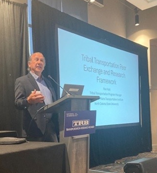
Ronald Hall: Tribal Summit
During the closing plenary, Ronald Hall from the Upper Great Plains Transportation Institute shared important insights about the challenges and opportunities faced by Tribal nations in transportation policy. He presented data and findings from the 2024 TRB National Tribal Peer Exchange, emphasizing the complexities of Tribal sovereignty. He highlighted the need for federal agencies to recognize and respect Tribal governance in transportation planning. He also noted that issues related to Tribal communities and equity often receive little attention due to the limited representation of Tribes, which make up only 2.9% of the population and occupy 2.3% of U.S. land. This absence of research in the social sciences has contributed to the erasure of indigenous data, complicating efforts to address the unique needs of these communities.
Panel: Future Workforce Strategies
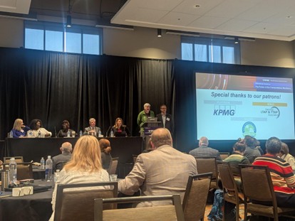
The day concluded by featuring a compelling discussion led by moderator Eric Rensel, President of Rensel Consulting. The panel concerned strategies to attract and engage emerging talent, as well as the specific skills needed for the 21st century. Key contributions were made by Karen Philbrick of the Mineta Transportation Institute, who emphasized the importance of education and training in developing a skilled workforce. Suzie Heap, Director at KPMG, highlighted innovative approaches to workforce engagement, while Jason Bittner, Principal at Applied Research Associates, discussed the role of technology in shaping future job roles. Chris Young, Director of Workforce Development for the Texas Department of Transportation, rounded out the conversation by addressing the ongoing challenges and opportunities within the transportation sector, reinforcing the need for collaboration and forward-thinking solutions.
Day 2: Morning Workshops
Breakout A: Increasing Applicant Pools for Transportation Jobs
The transportation industry is facing an aging workforce, loss of institutional knowledge, and a lack of employment opportunities and awareness across potential stakeholders. Breakout A featured six diverse presentations offering innovative strategies to expand and diversify the transportation workforce to address these issues. Early outreach was a common theme, including a youth-led social media contest presented by Samuel Ricord from SRF Consulting, which engages high school students and early-career engineers through peer-created content and cash prizes. Michigan DOT is addressing workforce gaps by investing in infrastructure, targeting K-12 outreach, expanding training programs, and removing access barriers. Syed Ashik Ali, from the University of Oklahoma, emphasized listening to communities and co-creating solutions, especially in rural areas. Other strategies included recruiting veterans, retirees, and people with disabilities through tailored messaging, flexible roles, and partnerships. Together, these efforts aim to build a more inclusive and future ready workforce.
Breakout B: K-12 Priming the Career Track
This session emphasized the importance of introducing students to the transportation industry at an early age, even earlier than high school. There is a common misconception that careers in the transportation industry are confined to frontline operational roles such as bus drivers or railway workers. By broadening the students’ understandings earlier on, educators can open the door to a wider range of career trajectories within the industry. The presenters shared examples of current programs in collaborations with state agencies and colleges that provide young students with educational exposure to the transportation sector. A key theme across all three of the speakers was the need to ensure these opportunities are equitable and accessible to students from diverse socioeconomic backgrounds.
Breakout C: Experiential Education and Apprenticeships
Three panelists presented their apprenticeship programs and shared the benefits and outcomes of their collaborations. Nicola Lowe, of the University of Minnesota School of Public Affairs, discussed the benefits of developing a two-year apprenticeship program which enables individuals to work part-time for two years while taking University of Minnesota courses to transition into careers as transportation planners. Apprentices engage in on-the-job training and develop career experience without incurring any debt. Additionally, employers have observed improved retention rates among participants in the apprenticeship program. This approach to professional development provides a pathway to career opportunities for a far more diverse results in a more representational and diverse workforce than would have otherwise been possible.
Stephanie Ivey, of the Southeast Transportation Workforce Center, discussed the collaboration between the engineering undergraduate students at the University of Memphis and area businesses. Ivey has found that this apprenticeship program is attracting engineering students from all engineering disciplines to the transportation sector. She’s also finding that longer internships/apprenticeships result in individuals being offered jobs and staying within the transportation sector for the long-term.
Apprenticeships attract a more diverse pool of individuals to the transportation sector, as people are able to learn on the job and without taking on educational debt. This results in the workforce reflecting the communities they serve and increasing the applicant pool by attracting and developing local talent.
Day 2: Afternoon Workshops
Breakout A: Capacity of States to Deliver on Infrastructure
In the face of a shrinking workforce, state DOTs must efficiently and effectively attract a large candidate pool to deliver on future infrastructure projects. Each panelist addressed strategies which they have implemented to attract a high volume of candidates. Bryan Pounds from McKinsey & Company spoke about the importance of completing an internal and external labor analysis to better align potential candidate skill sets with agency priorities. Chris Young, the Director of Human Resources at the Texas Department of Transportation, highlighted the importance of tailoring each job posting to the needs of the specific project as opposed to recruiting for a specific type of candidate. This will attract a broader applicant pool and make positions easier to fill. Keith Benjamin from STV suggested the need for a shift in leadership among DOTs to change the culture which makes it more attractive to candidates. Kelly Hutchinson from the New Jersey DOT (NJDOT) emphasized her approach to hiring is “finding good people to train, rather than search for specific skills.”
Breakout B: Preparing the Transportation Workforce for Emerging Technologies
Rhonda Young, of Gonzaga University, discussed the challenges of emerging technologies in the transportation sector. Young is the Chair of the Department of Civil Engineering at Gonzaga University. She led three breakout sessions and grouped panel attendees by the sector in which they worked: Academia, DOTs, Local Technical Assistance Program (LTAP), and consultants. Each group discussed the challenges they’ve faced with the adoption of artificial intelligence and other emerging technologies. This session provided participants with ample opportunities to exchange ideas and solutions to present-day organizational challenges many in the transportation sector are currently facing.
Breakout C: Fostering a Resilient and Adaptable Transportation Workforce
Lori Richter and Hyun-A Park of Spy Pond Partners explored how agencies can foster a resilient and adaptable workforce by using the Agency Capability Building (ACB) framework to guide strategic change. They introduced the ACB portal, a site offering tools and resources to support evolving workforce needs. Designed to help agencies respond to challenges such as generational skill gaps, staff burnout, leadership shortfalls, and competition with the private sector, the framework emphasizes identifying change forces, assessing organizational needs, and developing strategic responses. Through self-assessments, playbooks, and strategy guides, the portal helps agencies align internal systems with long term goals, empowering them to adapt in a rapidly changing transportation landscape.
Day 3
Innovations and the Workforce of the Future
The Moonshot Program
The Moonshot Program is a joint initiative between TRB and AASHTO aimed at transforming transportation systems to better serve economic and community needs. With 11 states leading the initial deployment, the Program encourages agencies to prepare for the future by leveraging 12 strategic areas including partnerships, human resources, and technology.
- TxDOT showcased its innovation corridor between Houston and Dallas, where driverless trucks are now making deliveries. They highlighted the importance of adapting hiring and training programs to match modern learning preferences, such as LinkedIn Learning and video-based educational formats.
- NJDOT shared infrastructure upgrades at the nation’s deadliest intersection, using intuitive traffic lights to prevent crashes. They also stressed the importance of community engagement and “grow[ing] their own” by developing internal talent pipelines, hiring at all levels, and creating targeted opportunities for Asset Limited, Income Constrained, Employed (ALICE) populations.
Keynote Panel
To wrap up the plenaries, three speakers focused on preparing the transportation workforce for emerging challenges and opportunities:
- Pierre Bouquet of Massachusetts Institute of Technology, explored the growing influence of AI in transportation, noting that up to 1.1 million workers could be impacted, but with thoughtful adoption, agencies could realize a 5% productivity boost and save $1 billion.
- Tim Main followed with a session on empathy in the workforce, emphasizing the importance of understanding employees’ lived experiences, such as those in ALICE households
- Tyler Reeb wrapped up the sessions by introducing the concept of ‘pizza teams’ to promote cohesion and belonging. He underscored the value of small, tightly knit teams that foster collaboration and camaraderie among colleagues.
“Imagine what power for change there would be if one of the results of our Summit gathering was an interconnected group of (purpose-driven) pizza teams”
-Tyler Reeb
Day 3: Morning Workshops
Breakout A: Changing and Enhancing Organizational Culture.
Virginia Stubella, of New Mexico Department of Transportation and David Sklar, of WSP and MDOT presented. Stubella presented a talk titled Committing to the Future: Investing in People to Build a Culture of Continuous Improvement, the result of a collaboration she did with Hyun-A Park, of Spy Pond Partners. Their efforts culminated in a Knowledge Book, a compilation of process documentation, Standard Operational Procedure’s, and business best practices. This Knowledge Book serves the need for succession planning at a time when record numbers of long-term employees are retiring, by capturing their decades of knowledge and experience. This Knowledge Book resulted in greater institutional agility and staffing adaptability and will be continuously revised and updated to reflect evolving organizational needs as they develop.
David Sklar presented MDOT’s Journey to Build and Strengthen the Asset Management Workforce. Sklar discussed the inception of the Asset Management Program at MDOT. The program was launched in 2017, an Asset Management steering committee was formed, additional committees handling specific areas of work were formed, and an A.M. office was opened and fully staffed. Also, an Asset Management career pathway was developed. This program requires ongoing cross-modal interaction and effort and has resulted in strengthened stakeholder awareness and dedicated efforts to ensure a more reliable and cohesive transportation system serves the people of Minnesota.
Breakout B: Embracing Innovation and Continuous Learning
Investing in a human-centric future for the transportation industry was a key theme of the embracing innovation and continuous learning breakout session. John Saturley from the City and County of Denver spoke about his organization’s focus on creating a healthy workplace culture through psychological safety. For example, Saturley shared that in an effort to prioritize psychological safety, the City and County of Denver is working on providing personal protection equipment (PPE) that is designed to fit women. Doing so would foster a safer and more comfortable work experience as typical PPE is manufactured to fit a larger body size and ill fitting gear can compromise worker safety. James Shaw and Elsie Dedecker from ARUP spoke about building organization resilience in response to potential uncertainty surrounding rapidly developing technology in the workplace. They identified that a key way to build organizational resilience is through cultivating a greater and more explicit connection to purpose across your workforce. Gary Vansuch from the Colorado Department of Transportation (CDOT) spoke about using the LEAN process improvement model which is a commitment to continually invest in its people. CDOT improves their business through CDOT’s LEAN everyday ideas program which directly addresses challenges by allowing employees to submit problems, solve them, and make improvements. This program fosters fundamental change within the organization while also sparking facilitation, improvement program management, and change management.
Breakout C: New Business Models
In this session, Amanda Olive of the North Carolina Department of Transportation (NCDOT) shared the innovative steps they are taking to expand their recruitment outreach. By getting creative with their approach, NCDOT has enhanced their recruitment platforms through internal improvements like better compensation packages, expanded mental health resources, more effective hiring events, and increasing the number of internship opportunities. They also highlighted their use of in-person outreach efforts like setting up informational tents at football games to engage with the public directly. This provides the public with a more accessible way to learn more about the careers available to them. The overall messaging conveyed by NCDOT was the importance of understanding people’s needs and aiming to make sure the organization can meet those needs.
Day 3: Afternoon Workshops
Breakout A: Partnerships
During Breakout A’s partnership discussion, moderator Garrett Wheat, Statewide Strategic Program Manager at Louisiana Department Of Transportation and Development, facilitated a conversation with LaShaundra Shaw of the Texas Department of Transportation (TxDOT), who emphasized the importance of strategic workforce development through active community engagement. Shaw highlighted various initiatives that aim to align workforce skills with the needs of local industries, fostering a more robust job market. Susan Baillargeon of Front Range Community College shared insights into creating professional development pathways that leverage partnerships between educational institutions and employers, ensuring that graduates are well-equipped for the workforce. Larry Williams from the Oregon Bureau of Labor Industries presented Oregon’s innovative apprenticeship-related childcare model, showcasing how it addresses the barriers faced by working parents in entering and completing apprenticeship programs. Together, these speakers emphasized the important role of collaboration across sectors in shaping a skilled workforce that meets the evolving demands of the economy.
Breakout B: Metrics and Measurements
This session focused on the critical role of data in shaping the future of the transportation workforce. Three speakers presented their research on topics such as analyzing nation datasets to explore transportation employment, using transit workforce metrics to measure outcomes and progress, and forecasting staffing and training needs. A key takeaway was the importance of collecting data early, regardless of its complexity. The speakers emphasized that starting with simple data tracking is far better than having no data at all. Additionally, combining qualitative data methods such as pairing interviews with surveys can enhance its value and provide more comprehensive insights.
Breakout C: Staying Ahead of the Curve: AI, ITS, C/AV and Infrastructure
Amanda Holland of Holland Enterprise Resource and Katherine Turnbull from the Texas A&M Transportation Institute presented the current trends and strategies their respective organizations are using to adopt artificial intelligence. Holland emphasized that while artificial intelligence won’t replace workers, those who know how to leverage it will. She described the convergence of knowledge, people, and artificial intelligence as a critical moment to rethink workforce development and training. As artificial intelligence continues to become more prevalent, the transportation industry must make intentional choices around adoption, with a focus on accuracy, ethics, and data privacy. Both presenters stressed the importance of adapting to technological change and highlighted how these innovations can create opportunities for collaboration, upskilling, and job growth across the sector.
Conclusion
The TRB National Summit made one thing clear: the future of the transportation workforce depends on our willingness to adapt new techniques and lead with purpose. Across three days of panels, keynotes, and collaboration, equity emerged as a central pillar, reminding all of us that a sustainable workforce must reflect the diversity of the communities it serves. Speakers called upon us to look beyond résumés and recognize the value of experience, skills, and overall human potential. They spoke about the integration of new technologies, including AI, as an opportunity to prepare workers not only to keep up with change but to help drive it. We were all challenged to dismantle outdated mindsets such as what one panelist termed “toxic nostalgia” and build cultures of feedback, trust, and growth. The summit wasn’t just about sharing best practices, it was about igniting a movement and creating connections. As we return to our organizations, we carry with us a shared commitment to shape a transportation workforce that is innovative, inclusive, and future-ready.
This report was authored by graduate and undergraduate student interns at the Colorado Department of Transportation:
- Alexa Fitzpatrick, Office of Process Improvement Intern at CDOT, BAS Emergency Service Administration
- Charlotte Pulido, Office of Process Improvement Intern at CDOT, B.A. Environmental Science
- Devin Wilson, Office of Process Improvement Intern at CDOT, Masters in Public Policy
- Hildana Liben, Office of Process Improvement Intern at CDOT, B.A. Political Science
 Apprenticeship Program Best Practices Guide
 The Highway Construction Apprenticeship Development Guide—a companion piece to the Playbook—was developed by CITT’s Education and Workforce Development Analyst Deanna Matsumoto and Research Assistant Caitlin Mace, as part of a Southwest Transportation Workforce Center grant awarded to CITT by FHWA. As part of her work, Matsumoto and a team of research assistants conducted semi-structured telephone interviews with the Working Groups/Task Forces for ten out of the twelve HCWP pilot locations in order to gain insight on each Working Group’s best practices. The Guide matches pilot program recommendations with plays from the Playbook. A future update of the FHWA Playbook will incorporate CITT’s work to produce a final, comprehensive document.
 The Guide also develops additional recommendations for future career development programs, building upon those addressed in the Playbook. It recommends implementing many progressive strategies for outreach such as using social media to recruit workers, creating a “no wrong door” policy that seeks to fit potential workers into positions that best suit their skills, and targeting areas where mobility infrastructure development was a high need, thereby facilitating economic development for communities through mobility in addition to job creation. Other innovative recommendations included facilitating childcare services for employees, addressing transportation obstacles through ride-sharing and similar programs, and case management services to assist with external factors that play into career success such as housing, food insecurity, substance abuse, and financial literacy education. These recommendations were all pulled from best practices identified through the interviews with the FHWA Pilot Program managers.